Utah Drawn Will be on Display at the Utah State Capitol through the End of the Summer
 The American West Center at the University of Utah has contributed four maps to Utah Drawn: An Exhibition of Rare Maps, a collaboration between the Utah Division of State History and the Capitol Preservation
Board. The exhibit combines original maps with a handful of facsimiles to tell a cartographic
history of the region that came to be Utah from 1550 t0 roughly 1900. Created in collaboration
with the Ute Indian Tribe, Uintah and Ouray Reservation in 1988, the Center’s maps
make a significant contribution to the exhibit’s inclusion of Utah’s native peoples
and their history.
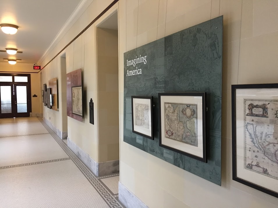
The American West Center at the University of Utah has contributed four maps to Utah Drawn: An Exhibition of Rare Maps, a collaboration between the Utah Division of State History and the Capitol Preservation
Board. The exhibit combines original maps with a handful of facsimiles to tell a cartographic
history of the region that came to be Utah from 1550 t0 roughly 1900. Created in collaboration
with the Ute Indian Tribe, Uintah and Ouray Reservation in 1988, the Center’s maps
make a significant contribution to the exhibit’s inclusion of Utah’s native peoples
and their history.
Utah Drawn explores themes familiar to westerners, including exploration, land use, and resource extraction. The original maps come from the collection of local businessman Steve Boulay and include pieces that range from Sebastian Münster’s 1550 depiction of the Americas to the published map of John C. Frémont’s expeditions of 1842–1844. Careful observers can even find a Spanish-language reference to Bear’s Ears (“orejas del oso”) in B.A.M. Froiseth’s striking 1871 map. The AWC’s own Travis Ross, who recently earned his PhD in history from the University of Utah, worked as the research historian and project manager on the exhibit.
Utah Drawn will be on display at the Utah State Capitol through the end of the summer.